
Githobokoni is a unique hiking destination located at the border of Kiambu and Murang’a counties, a place called Maatara, Gatundu. It’s renowned for its two distinct waterfalls, lush tea plantations and a challenging, steep trail with a significant descent and ascent through rugged terrain.
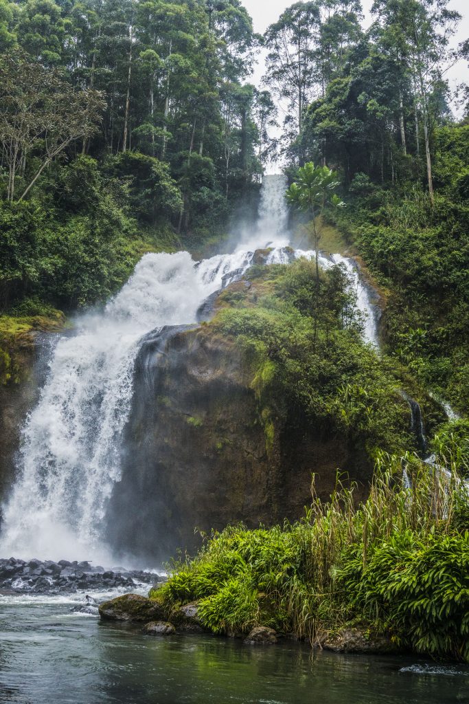
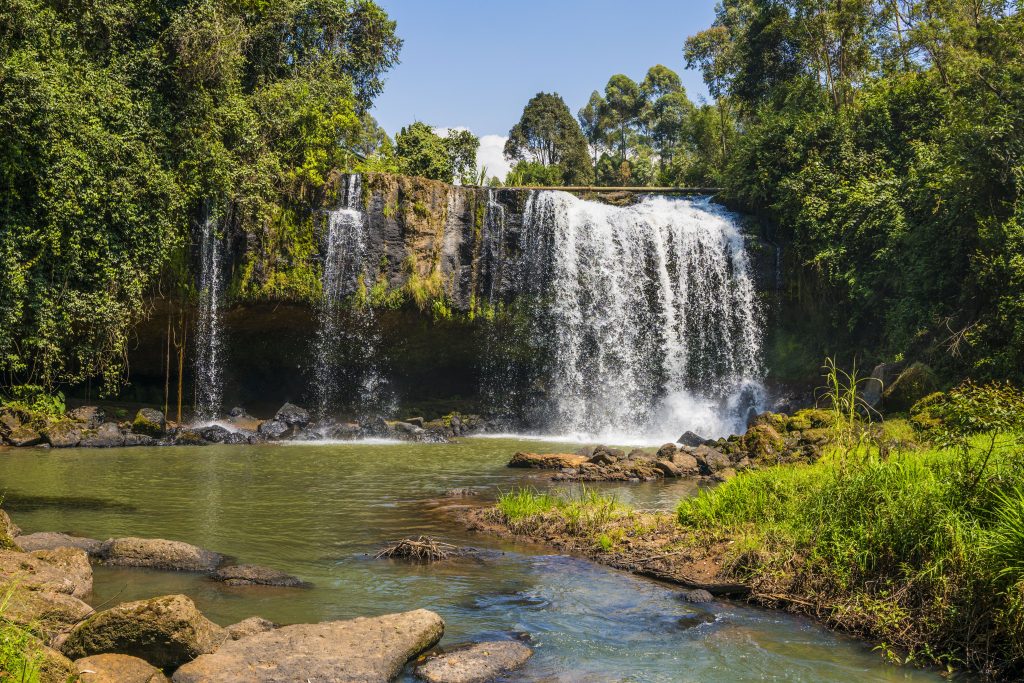
The trail of about 11km leads to two waterfalls, with the second one being particularly large, loud and spectacular and best of all, it’s suitable for swimming too. Our route takes us through several farm roads, tea plantations and more
The location offers a serene escape from city life, characterized by crisp, fresh air. The hike is considered moderate due to the steep descents and climbs through rugged landscapes at the 2nd waterfall.
The drive to the starting point is likely to take less than 2 hours, accounting for traffic and a washroom break along the way
 We’ll be using Thika road and then branch at Jomoko before arriving at Kariminu tea buying centre
- Hiking level – Moderate. Total hiking distance is around 11 km. Factors contributing are the steep descents and climbs through rugged landscapes, moderate altitude ascent, normal weather though it might be tricky when it rains, because the soil gets slippery.
- Main attractions – Hikers pass through lush tea plantations and diverse vegetation, with the potential to see different kinds of birds.
- Type of hike – Rural trek with a few forested sections and then waterfall visit
- Atmospheric conditions – Depends on the season but can be sunny and warm in the dry season
- Slipping hazard – Average as some sections and towards the second waterfall, there is steep descent and climb through rugged landscapes. When it rains, caution ought to be observed.
- Steepness – the main descent to the 2nd waterfall has a steep descent with a gradient of 25%. The rest of the trail is gentler
- Hiking path condition – Some roads are tarmacked while others are farm roads, thus open
- Water usage – Average to medium. Recommend a minimum of 2 litres because of the sunshine.
- Route visibility – The trail starts out with a visible road path that gets dusty, and a single file path.
10. Biodiversity – Numerous species of insects, flora, birds and diverse plantation


- Good hiking boots, walking stick, especially for the steep descent
- Sun hat – to protect against the sun/rain gear to protect against rain and waterfall sprinkle.
- Water – at least 2 litres
- Snacks and lunch – we recommend you bring snacks and lunch to eat while relaxing at scenic locations along the route

